
5.3: Food Systems in the Physical Landscape
- Page ID
- 21991
British Columbia food systems reflect regional biophysical factors, human behaviour and the political-economic relations in which food practices have evolved and currently exist. The main biophysical constraints to human food procurement in BC include landscape features (e.g., slope and elevation), soil fertility, climate, and water availability (both groundwater and precipitation).
Geologically speaking, British Columbia is a newcomer to North America, and most of the province has experienced dramatic geologic changes over the last 200 million years. The region as we know it today was created through tectonic movement (e.g., terraine deposition, earthquakes and volcanic eruptions) and climate-influenced, geomorphic processes (episodic glaciation, weathering, erosion and sediment transfer). As a result, BC has a “pointy” landscape with several difficult-to-traverse mountain ranges and relatively few areas of high soil fertility suitable for conventional agricultural practices.
The highest soil fertility is primarily located in sinuousriver valleys and deltas much like the Fraser River Valley. In fact, of the province’s 92,250,929-hectare land base, the Canadian Land Inventory estimates that only 5% is suitable for agriculture, 2.7% is capable of growing a reasonable range of crops and 1.1% is prime agricultural land (Smith, 2012).
While the geography of soil fertility is severely constrained in BC and largely determinative of the major agricultural regions, agricultural capability of the land is measured by the Canadian Land Inventory,[1] which includes soil fertility as just one of many considerations in ranking lands on a seven-class scale as shown in Table 1.
Class 1 is prime agricultural land that has no significant limitations and is suitable for most crops while Class 7 is land unsuitable to agriculture. The seven-class scale is modified by 16 subclasses that provide information on the kind of management problem or use limits that might exist for agricultural land; for example, erosion (E), excess water (W), salinity (N) and stoniness (P) (see Table 5.2).
| Class 1 Class 1 land is capable of producing the very widest range of crops. Soil and climate conditions are optimum, resulting in easy management. |
| Class 2 Class 2 land is capable of producing a wide range of crops. Minor restrictions of soil or climate may reduce capability but pose no major difficulties in management. |
| Class 3 Class 3 land is capable of producing a fairly wide range of crops under good management practices. Soil and/or climate limitations are somewhat restrictive. |
| Class 4 Class 4 land is capable of a restricted range of crops. Soil and climate conditions require special management considerations. |
| Class 5 Class 5 land is capable of production of cultivated perennial forage crops and specially adapted crops. Soil and/or climate conditions severely limit capability. |
| Class 6 Class 6 land is important in its natural state as grazing land. These lands cannot be cultivated due to soil and/or climate limitations. |
| Class 7 Class 7 land has no capability for soil bound agriculture. |
| A | Soil moisture deficiency | M | Soil moisture deficiency |
| B | Wood in the profile | N | Salinity |
| C | Adverse climate (excluding precipitation) | P | Stoniness |
| D | Undesirable soil structure | R | Shallow soil over bedrock and/or bedrock outcroppings |
| E | Erosion | T | Topography |
| F | Fertility | W | Excess water (groundwater) |
| I | Inundation (flooding by streams, etc.) | Z | Permafrost |
| L | Degree of decomposition- permeability | H | Depth of organic soil over bedrock and/or rockiness |
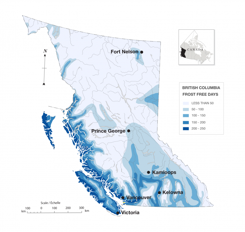
Frost-Free Days
The interaction of landscape with climate also leads to major constraints to the expansion of agriculture in BC. The number of frost-free days and growing degree days determines what kind of crops can be expected to successfully grow in different geographic regions. Frost-free days decline as elevation and latitude increase as shown in Figure 2.
Water Accessibility
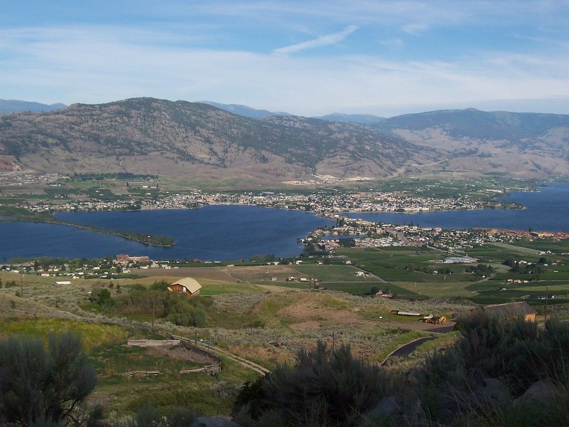
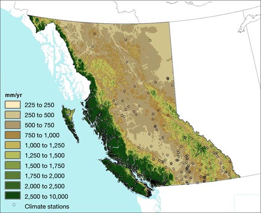
Water accessibility is also a factor in the success of agriculture. In many areas of the province, such as the semi-arid Okanagan valley, precipitation and groundwater resources are combined with irrigation technology to increase the water availability of crops. As much of the agricultural lands occur in river deltas and floodplains, there is also sometimes a need to pump excess water out of fertile soils.
Attributions
- Figure 5.1 Agricultural Regions of British Columbia from 2011 Census of Agriculture, BC Ministry of Agriculture, www.agf.gov.bc.ca/stats/Census/2011AgriCensusBCHighlights.pdf
- Figure 5.2 British Columbia frost-free days. Map of frost-free days by Hilda Anggraeni is an adaptation from the British Columbia Ministry of Agriculture (www.agf.gov.bc.ca/resmgmt/maps/frostfre.jpg) and Natural Resources Canada (atlas.nrcan.gc.ca/site/english/maps/reference/index.html#outlinecanada) licensed under CC-BY 3.0 (https://creativecommons.org/licenses/by/3.0/).
- Figure 5.3 The town of Osoyoos, British Columbia is in the Public Domain https://en.Wikipedia.org/wiki/Osoyoos#mediaviewer/File:OsoyoosBC.JPG
- Figure 5.4 Annual precipitation in British Columbia adapted from Impacts to Adaptation: Canada in a Changing Climate, Ch. 8, Figure 2 (www.nrcan.gc.ca/environment/resources/publications/impacts-adaptation/reports/assessments/2008/10253) by the Government of Canada Natural Resources and used under the non-commercial terms of license located at http://www.nrcan.gc.ca/terms-conditions/10847 .
- Canadian Land Inventory http://sis.agr.gc.ca/cansis/nsdb/cli/index.html↵