
9.2: Natural Hazards in East and Southeast Asia
- Page ID
- 21103

Much of what unites this region is its instability, not necessarily in terms of geopolitics, but rather its physical landscape. East and Southeast Asia are located in the Pacific Ring of Fire, an area of high tectonic activity along the Pacific Ocean basin (Figure \(\PageIndex{1}\)). The vast majority of the world’s earthquakes, around 90 percent, occur along this geologically unstable area.
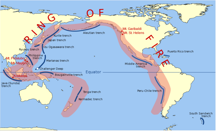
In East and Southeast Asia, tectonic collisions have shaped the physical landforms present in the region and present numerous natural hazards (Figure \(\PageIndex{2}\)). Volcanoes erupt in this region frequently, and many of the islands in this region were actually formed from a variety of historic volcanic eruptions. Japan’s highest mountain peak, for example, the majestic Mount Fuji, is an active volcano that last erupted in the early 18th century. The 1815 eruption of Indonesia’s Mount Tambora, one of its dozens of active volcanoes, was so powerful, it cooled global temperatures and caused crop failures as far away as Egypt and France. In 1883, the volcanic island of Krakatoa, between the Indonesian islands of Java and Sumatra, erupted with such a violent explosion that it actually collapsed. Tens of thousands died and it took several years for global weather patterns to return to normal. The sound of the eruption is considered the loudest sound in modern history and could be heard from over 4,800 kilometers (3,000 miles) away.
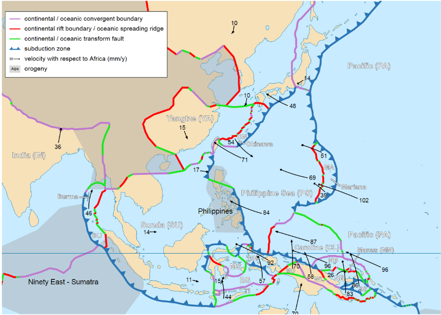
Along the islands of Indonesia, the Australian Plate is subducting, or moving below, the Eurasian Plate. This has resulted in a subduction zone west of the Indonesian island of Sumatra, an area of high seismic activity. In 2004, this subduction resulted in a massive undersea earthquake, so powerful that it actually shortened the day by a fraction of a second. The earthquake triggered a series of tsunamis, high sea waves, which devastated coastal communities in 14 different countries and killed 230,000 people. Tsunamis result from the displacement of water and can have a variety of causes, such as a landslide, meteor impact, or undersea volcanic eruption. Most commonly, though, they result from earthquakes.
In 2011, the most powerful earthquake to ever hit Japan, a magnitude 9.0, resulted in tsunami waves over 40 meters (131 feet) high in some areas. The earthquake and subsequent tsunami left over 15,000 dead and damaged hundreds of thousands of buildings. Most notably, the tsunami damaged Japan’s Fukushima Daiichi Nuclear Power Plant causing a series of nuclear meltdowns and the release of radioactive material.
So what can be done about the danger from earthquakes, volcanoes, and tsunamis in this region? While nothing can stop Earth’s massive tectonic plates from moving, warning systems, land use planning, and public education could help prevent casualties. After the 2004 Indonesian earthquake and tsunami, the international community created an Indian Ocean tsunami warning system. Although some of the hardest hit areas would have had only minutes to find higher ground, the warning system could have had a significant impact in alerting areas ahead of the wave. In Japan, earthquake drills are common and strict building codes ensure that buildings can withstand most seismic activity.
In addition to these geologic hazards, typhoons are also common in this region. Typhoons, the term for tropical cyclones in the northwestern region of the Pacific Ocean, routinely make landfall in East Asia. The region actually has more tropical cyclone activity than anywhere else on Earth. Most storms form in the summer between June and November and the islands of the Philippines are generally the hardest hit. Monitoring systems have been in place in the region for several decades and have helped to minimize the impacts from these powerful storm systems.
- Pacific Ring of Fire:
-
an area of high tectonic activity along the Pacific Ocean basin
- Subduction Zone:
-
an area where one tectonic plate is subducting, or moving below, another plate
- Tsunami:
-
a high sea wave resulting from the displacement of water