
17.3: Urbanization and the Development of Cities
- Page ID
- 57122

\( \newcommand{\vecs}[1]{\overset { \scriptstyle \rightharpoonup} {\mathbf{#1}} } \) \( \newcommand{\vecd}[1]{\overset{-\!-\!\rightharpoonup}{\vphantom{a}\smash {#1}}} \)\(\newcommand{\id}{\mathrm{id}}\) \( \newcommand{\Span}{\mathrm{span}}\) \( \newcommand{\kernel}{\mathrm{null}\,}\) \( \newcommand{\range}{\mathrm{range}\,}\) \( \newcommand{\RealPart}{\mathrm{Re}}\) \( \newcommand{\ImaginaryPart}{\mathrm{Im}}\) \( \newcommand{\Argument}{\mathrm{Arg}}\) \( \newcommand{\norm}[1]{\| #1 \|}\) \( \newcommand{\inner}[2]{\langle #1, #2 \rangle}\) \( \newcommand{\Span}{\mathrm{span}}\) \(\newcommand{\id}{\mathrm{id}}\) \( \newcommand{\Span}{\mathrm{span}}\) \( \newcommand{\kernel}{\mathrm{null}\,}\) \( \newcommand{\range}{\mathrm{range}\,}\) \( \newcommand{\RealPart}{\mathrm{Re}}\) \( \newcommand{\ImaginaryPart}{\mathrm{Im}}\) \( \newcommand{\Argument}{\mathrm{Arg}}\) \( \newcommand{\norm}[1]{\| #1 \|}\) \( \newcommand{\inner}[2]{\langle #1, #2 \rangle}\) \( \newcommand{\Span}{\mathrm{span}}\)\(\newcommand{\AA}{\unicode[.8,0]{x212B}}\)
The Earliest Cities
Key Points
Key Terms
The Formation of Cities
Preindustrial Cities
Key Points
Key Terms
Cities as Political Centers
Trade Routes
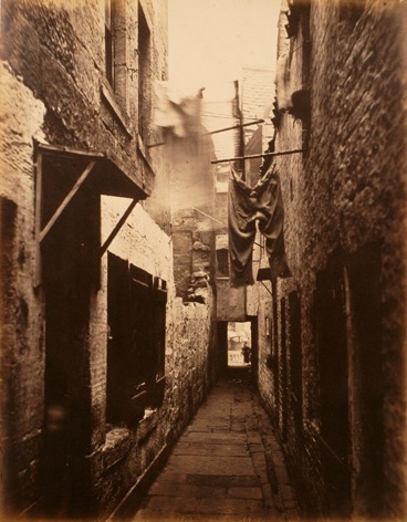
Industrial Cities
Key Points
Key Terms
The Structure of Cities
Key Points
Key Terms
Urban Structure Models
Grid
Concentric Ring Model


Sectoral

Multiple Nuclei
Irregular Pattern
Alternate Uses of “Urban Structure”
The Process of Urbanization
Key Points
Key Terms
Urbanization and rural flight


A link to the YouTube element can be found in Contributors & Attributions section.
Economic and Environmental Effects of Urbanization
Suburbanization and Counterurbanization
U.S. Urban Patterns
Key Points
Key Terms

The Rural Rebound
Key Points
Key Terms
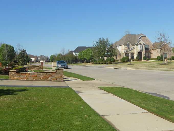
Suburbanization
White Flight
Models of Urban Growth
Key Points
Key Terms
Growth Machine Theory
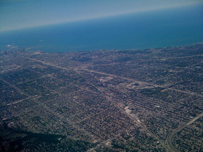
Urban Sprawl
Urban Decay
BROKEN WINDOWS
RESPONSES TO DECAY

Contributors and Attributions
CC licensed content, Specific attribution